
Mount Timpanogos via the Timpooneke Trail is a beautiful and popular hike that dominates Utah County. Timpanogos is the second highest peak in the Wasatch at 11,749 feet, just below Mt. Nebo (11,928 feet) to the south. Along this route, hikers have the opportunity to see an alpine lake, a small glacier, waterfalls, alpine meadows, wildflowers, and on occasion, Rocky Mountain goats.
The Mount Timpanogos hike via Timpooneke is about 12.7 miles roundtrip with an elevation gain of roughly 4,580 feet, and normally takes 4.5-5 hours to complete. The trail is well maintained and has a good mixture of varrying terrain. There are quite a few areas with switchbacks, and the scenery is stunning. Timpooneke isn’t a very difficult trail, but it does some time to hike it.
The Timpooneke Trail starts by heading into a thick forest from the Timpooneke Campground. For the first half mile, Engelmann spruce along with other evergreens shade the trail, and it starts to climb along a gentle grade. You’ll hike into a wide meadow on the valley floor and traverse above the west side for about 0.4 miles. Around mile one you’ll cross the first series of small streams trickling across the trail. There’s a signed junction for Scout Falls at 1.4 miles. Take a left and walk less than 100 yards to view moss-lined falls surging over a limestone ledge. Turn right and continue up the trail. At 2 miles, you'll begin climbing up the first major step in the Giant Staircase. Miles three and four have you crossing a sweeping talus field and then heading up a steady incline, weaving through stunted subalpine fir trees and Indian paintbrush, where views will begin opening up to the north of Box Elder Peak and Lone Peak. Timpanogos Basin is at mile 4.4, and there will be a trail leading to Emerald Lake and the Aspen Grove Trail that breaks off on the left as you enter the basin. If you’re not feeling super adventurous, the Emerald Lake Trail is a good alternative that is 6.5 miles with an elevation gain of 3,210 feet instead of the 4,580+ feet if you continue on the Timpooneke Trail.
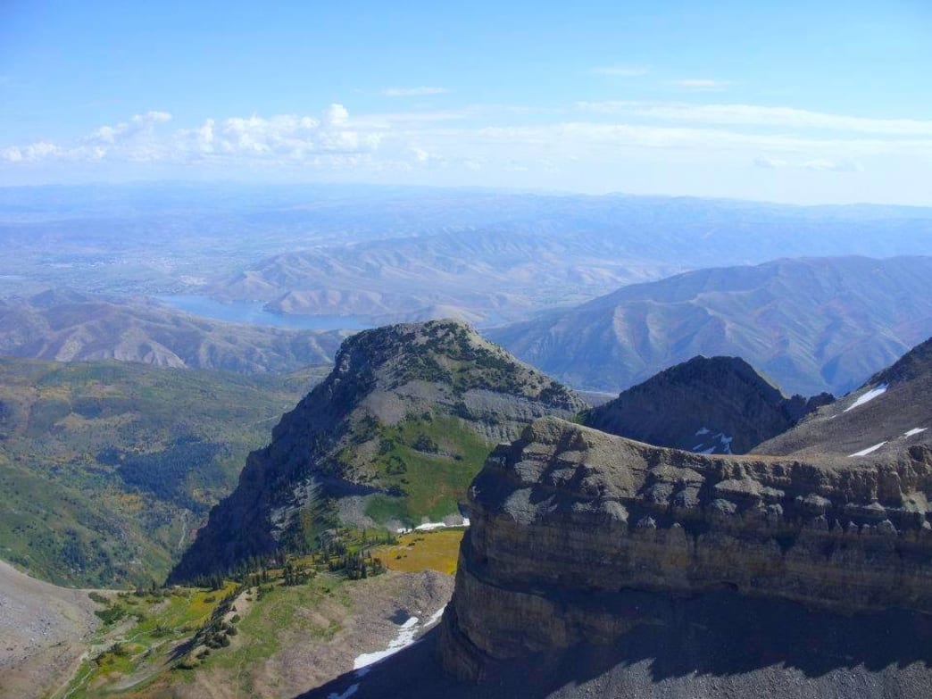
At 5.5 miles, the trail reaches an 11,000-foot pass. This is a good place to stop and take a rest should you need one. Relax, have a snack and prepare yourself for the last 2 miles toward to the summit. Once you step through the rocky gap onto the west of the ridge and continue climbing, the route traverses broken limestone slopes to the south before climbing along the ridge to the peak’s apex. Once you reach the summit, you’ll see an old metal hut with a red triangular roof, and there’s a book you can sign your name in with the date you summited Timp.
At the summit of Timpanogos, you’ll be blown away by the incredible views you have of the valley. There are several places to sit and take in the scenery. Let it soak in while you prep yourself for the hike down.
When hiking to the summit of Timp, make sure you pack plenty of snacks. You’ll need fuel to get you through the switchbacks. Hiking poles don’t hurt to bring along as well. Bring plenty of hydration and a light jacket, as it can be pretty breezy at the top. Dogs are allowed as long as they are on a leash. Many people do a sunrise hike, so they start late at night to summit Timp early in the morning before the sun rises. If you do it this way, take headlamps, jackets, and make sure to dress warm.
To get to the Timpooneke Trailhead from Salt Lake, take I-15 South and drive 25 miles to the Highland/Alpine Exit (Exit #284) and head east on Highway 92 towards American Fork Canyon (about 16 miles). When you reach the fork in the canyon, take the right fork, which is part of the Alpine Loop. Continue driving until you reach a sign on the right side of the road those points to the Timpooneke Campground. Take the paved side road ¼ mile through the campground. Just past the campground, the road reaches the trailhead. This is identified by a large paved parking lot with a vault toilet on the left side of the road. There is a $6 fee for a three-day pass for American Fork Canyon. The America the Beautiful Pass is accepted here.
Written by Erica Jessop for RootsRated and legally licensed through the Matcha publisher network. Please direct all licensing questions to legal@getmatcha.com.


 to the south. Along this rou...&media=//www.ogdenmade.com/cdn/shop/articles/vp3stdnkktyjaxqduiu0_600x.jpg?v=1627841683)